Capivari River basin in detail
The Technological Research Institute (IPT) delivered today, March 17th, to the City of Campinas the results of the floodplain delimitation project, refinement of the susceptibility map to floods and mapping of floodable areas of the Capivari river basin, in the section covered by the watercourse in the city – the river rises in the municipality of Jundiaí and flows into the Tietê river, in the city of the same name, also passing through the municipalities of Louveira, Vinhedo, Valinhos, Monte Mor, Elias Fausto, Capivari and Rafard.
The main activities carried out throughout the project, which began in February 2022 and ended in February 2023, involved the development of an innovative methodology for mapping the areas subject to flooding in the Capivari River basin and its tributaries, considering, in addition to three precipitation scenarios, current land occupation in the basin and a future occupation scenario, with a higher percentage of urbanization and, consequently, greater soil sealing.
“Hydrological modeling to transform rain into flow and hydraulic modeling to determine flood spots are already carried out routinely, the differential of this project was the innovative association of the two models, also incorporating variables related to urban planning, to trace a cause and effect relationship between the increase in urbanization and the consequent modification in the perimeter of the areas subject to flooding”, emphasizes researcher Dr. Filipe Antônio Marques Falcetta,
of the IPT’s Territorial Planning, Water Resources, Sanitation and Forestry Section and project coordinator.
The work also included the delimitation of the floodplain, using various data on a detailed scale, such as, for example, morphometry and pedology, and also the refinement of the flood susceptibility map of the Capivari basin and its tributaries, using the IPT methodology /CPRM revised, which takes into account relief pattern and altimetry data instead of morphometry.
According to Falcetta, the final result of the project includes a series of cartographic products that will allow the Municipality of Campinas to establish guidelines for land use and occupation in the Capivari river basin: “The mappings delivered to the City Hall consist of important tools for the City Hall to direct its territorial planning policies in the basin and, in the specific case of mapping areas subject to flooding, providing yet another justification for such areas not to be occupied and thus avoiding the creation of new areas at risk of flooding”.
DATA REFINEMENT – The first map of susceptibility to flooding in Campinas was drawn up by the IPT in July 2014 and revised, also by the Institute, in March 2015. Now, the work carried out by the team has reached refinement due to the access to data from greater detail.
“We were able to deliver the susceptibility chart for this portion of the territory to the municipality at a scale of 1:10,000; it was prepared from topographic data originating from a topographic survey carried out in LiDAR with high spatial resolution, and the previous map was on a 1:25,000 scale, having been generated with lower resolution topographic data”, explains the researcher, referring to technology known as LiDAR (Light Detection and Ranging) which does not only present a satellite image or aerial photograph, but a high-resolution geometric representation of a given area.
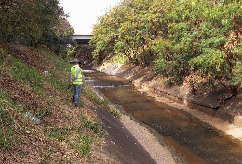
For the execution of the work, several meetings were held with City Hall technicians, allowing the right step of the project throughout the work and thus guaranteeing the fulfillment of the objectives sought by the municipal administration. A total of approximately fifty points were visited in the field, in a team made up of researchers and technicians from the IPT and technicians from the Secretariat for Green, Environment and Sustainable Development of the Municipality of Campinas, always accompanied by members of the Municipal Civil Defense.
“The information provided by city hall technicians, such as landfill sites, sites with old clay pits for the red ceramic industry, areas with garbage disposal, urbanized areas and other features observed in the field, such as profiles of soils exposed to the along the drains and in erosion, they contributed to the classification of the soils present there, allowing the correct characterization of the alluvial plains, which was the main objective of the project”, explains the IPT researcher.
Two complementary approaches were used in the project to proceed with the delimitation of the alluvial plain of the Capivari river, one of which is called morphometric and the other, pedological.
The validation of the mapping built using the two approaches was carried out through field work.
“The two approaches are complementary”, explains Falcetta. “Morphometry makes it possible to find relief patterns compatible with the occurrence of plains